Image
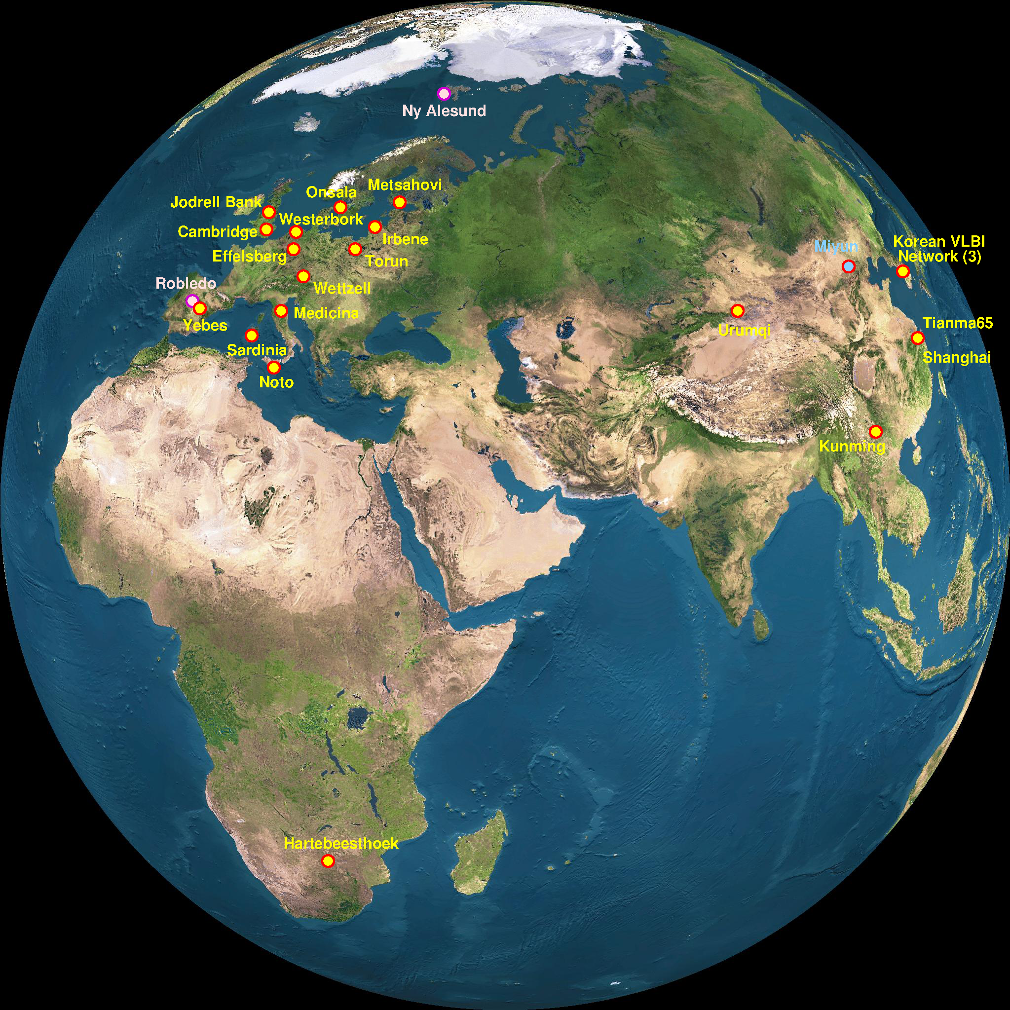
High-resolution EVN Map
You can right-click / Save image as to access the high-resolution version. When reusing this image please use the following copyright statement:
Image © Bob Campbell, the underlying map was generated using Fourmilab's EarthView, specifically this page to get a form to specify a "satellite-view" of the planet based on NASA's Blue Marble imagery.
The map shows the EVN and other participating stations and their status (colour-coded) using the following colour-coding table:
- Yellow/Red: current operational EVN stations
- Cyan/Red: existing telescopes soon to be EVN stations
- Cyan/Blue: new EVN stations under construction
- Pink/Purple: non-EVN stations that have participated in EVN observations
- Green/Brown: non-EVN stations with whom initial EVN tests have been carried out